Waukee Aerial provides professional drone construction documentation, orthomosaic mapping, aerial progress photography, and site video for active projects throughout Ankeny and the surrounding metro.
Our recurring drone documentation programs help contractors, developers, engineers, and project managers maintain a clear visual record of site progress from early site work through final completion.
Our work in Ankeny
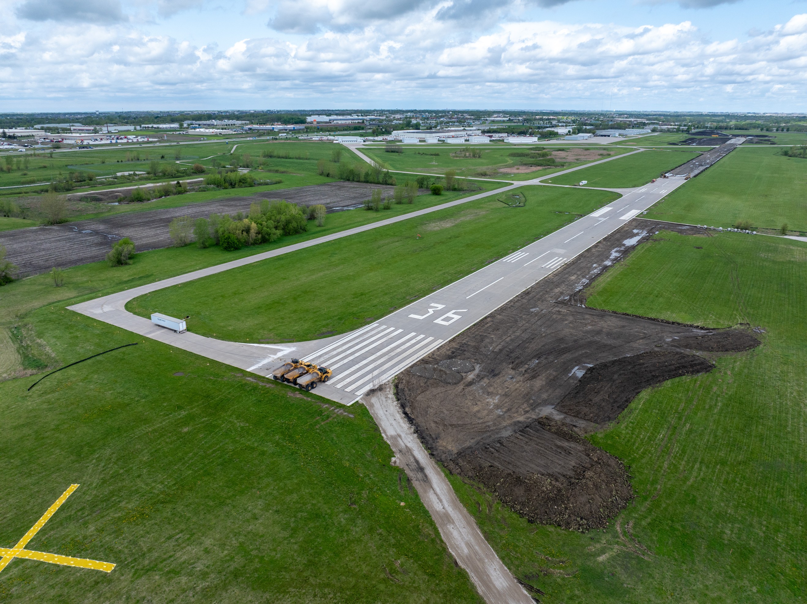
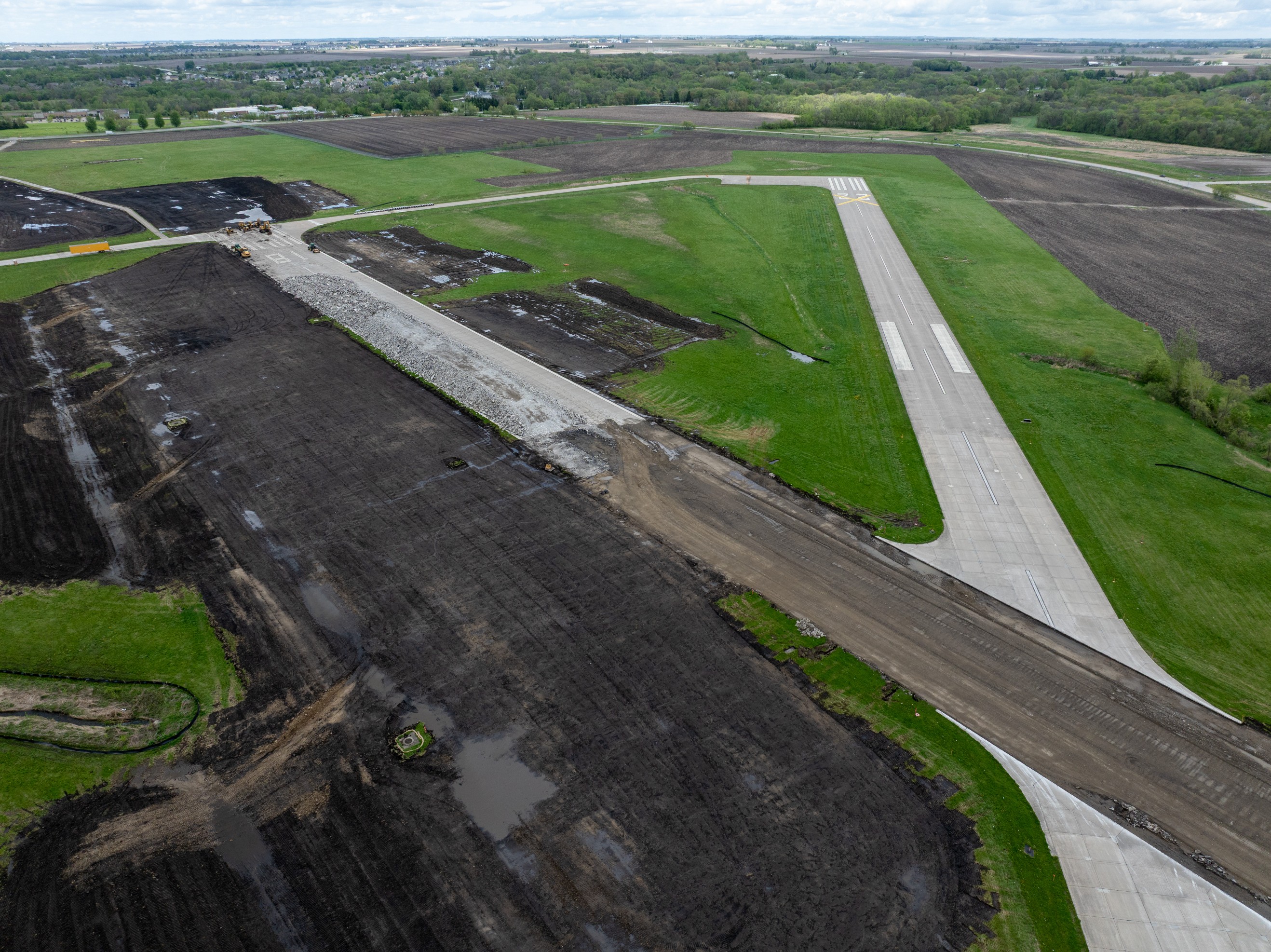
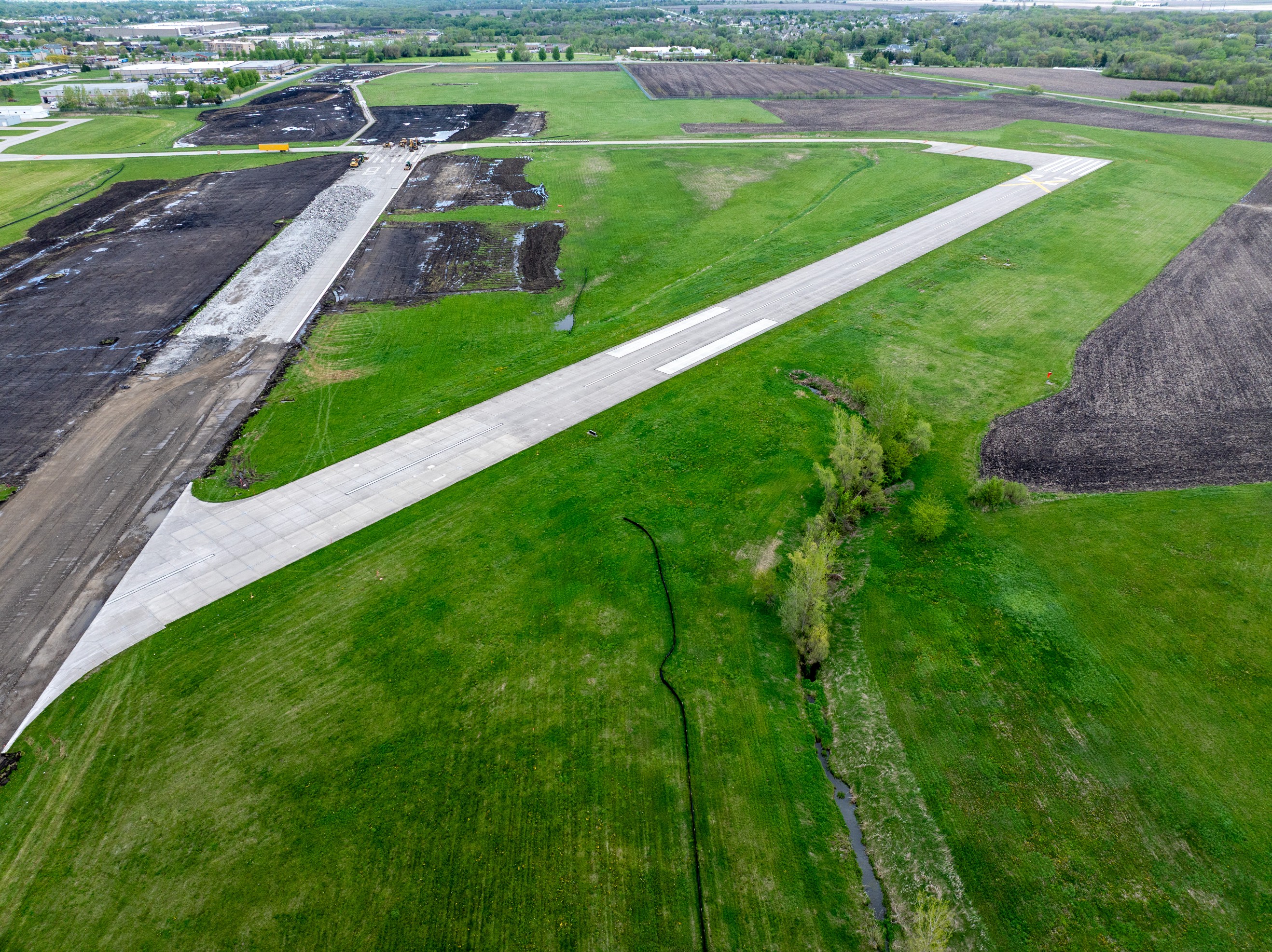
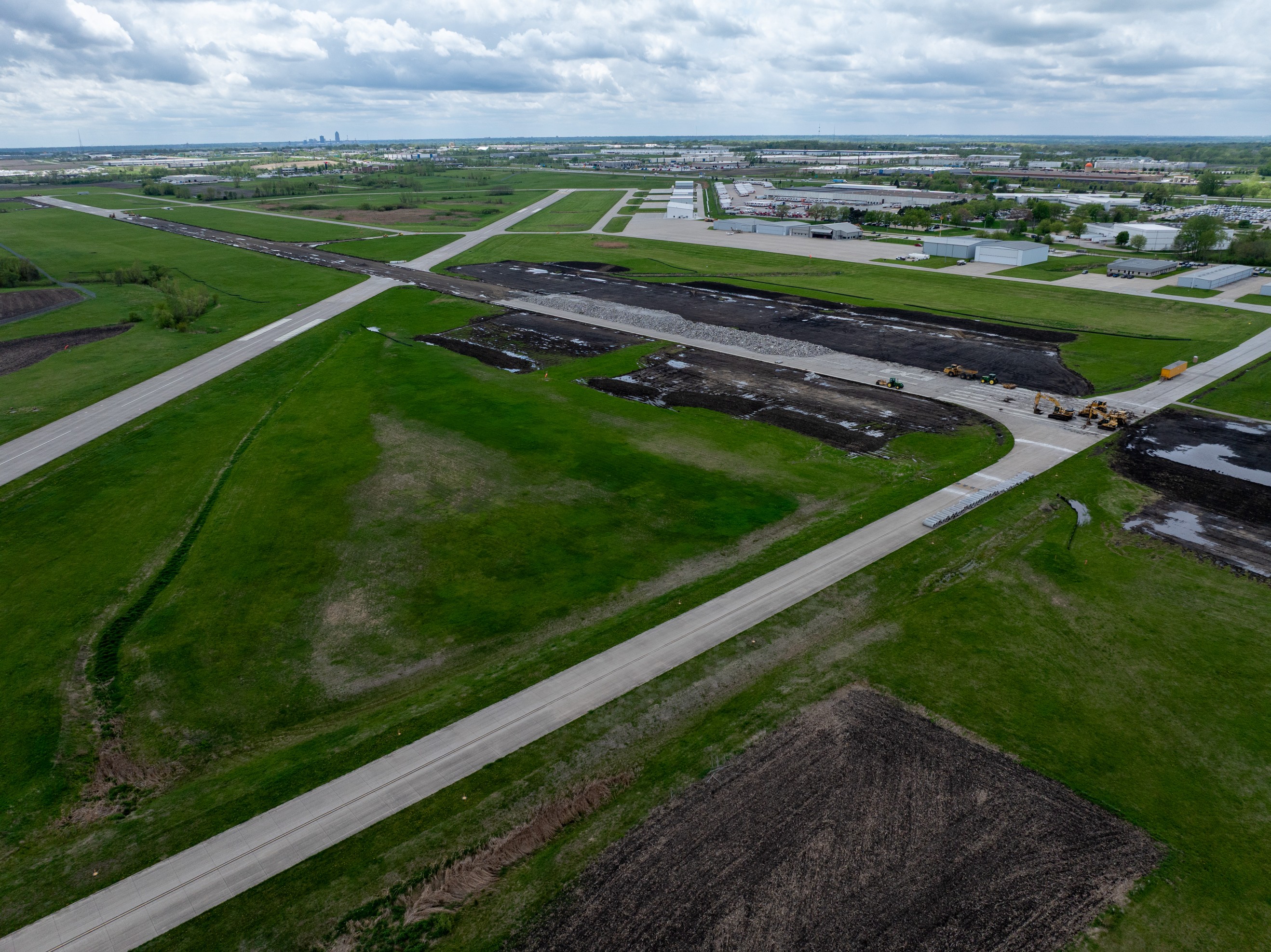
IKV is one of Iowa’s busiest general aviation airports, currently undergoing a major runway and taxiway reconstruction program. Waukee Aerial’s recurring documentation flights captured earthwork progress, paving sequences, and site logistics across multiple flights — delivering consistent aerial baselines the project team can actually use.
About Ankeny
Ankeny is one of Iowa's fastest-growing cities — population up from 67,887 in 2020 to over 76,000 by 2024, a sustained climb driven by residential expansion, commercial corridor development along Oralabor Road and Delaware Avenue, and a deep pool of large-scale civic, education, and infrastructure projects. Casey's General Stores headquarters sits on its southern edge, and the FFA national center anchors the city's identity. For construction teams, Ankeny means active commercial sprawl, school district expansion, and infrastructure work happening at suburban scale.
Ankeny continues to see major growth across commercial development, infrastructure improvements, industrial projects, and large residential expansion. Reliable aerial documentation helps teams monitor changing site conditions and communicate progress clearly to stakeholders.
Waukee Aerial specializes in recurring drone capture programs built specifically for construction projects. Each visit follows a consistent workflow so project teams can review progress over time and maintain organized documentation across the life of the project.
These deliverables are useful for progress meetings, owner updates, lender communication, marketing support, and maintaining a reliable visual archive of the jobsite.
Georeferenced overhead site maps stitched from dozens of overlapping frames. With RTK GPS, these maps are centimeter accurate — useful for monitoring grading activity, earthwork progress, and giving owners weekly proof of advancement across the full footprint.
Standardized aerial stills captured from the same angles and altitudes each visit. Shot-for-shot consistency means you can compare Week 4 to Week 12 at a glance — ideal for owner reports, insurance documentation, and dispute protection.
Milestone-ready site flyovers edited for stakeholder and executive review. Useful for owner updates, lender draws, and project marketing. Available as raw footage or lightly edited with title cards and your branding.
Immersive interactive panoramas that let remote stakeholders, project managers, or owners virtually walk the site from their desk. Ideal when in-person access is limited, or when you need a full-perimeter record at a specific project milestone.
Local context
One of Iowa's fastest-growing cities means dozens of concurrent commercial, residential, and civic projects in motion. GCs and developers operating multi-site programs need consistent visibility without doubling field-team time.
Ankeny Community Schools is one of Iowa's largest fast-growing districts. Each new school facility, addition, and athletic complex represents a multi-year build with public visibility expectations — aerial documentation supports both reporting and community communication.
Oralabor, Delaware, and the Highway 69 frontage host concentrated retail, office, and mixed-use development. Recurring aerial baselines compress the documentation overhead for portfolios spanning multiple commercial parcels.
Drone documentation is especially valuable on larger and longer-term projects where teams need consistent visibility without relying only on ground-level updates.
Waukee Aerial focuses on practical deliverables for active construction sites—not generic drone footage. The goal is to deliver organized, repeatable aerial documentation that helps teams make better decisions and communicate progress more effectively.
If your project would benefit from recurring aerial documentation, Waukee Aerial can help establish a drone capture program that fits your construction schedule and reporting needs.
Request a QuoteDrone services available